Galamsey 2026: Ghana Is Measuring Its Ruin With a Nineteen-Month-Old Number
Nineteen months of forest loss are missing
from the official record.
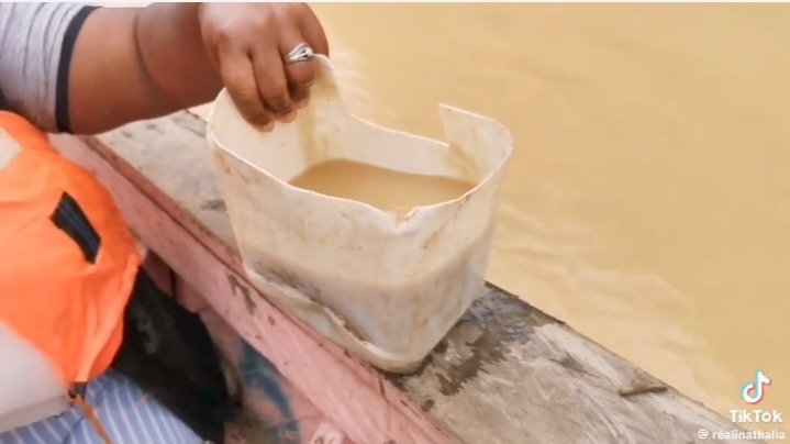
A (c) Joy News Video about Ankobra.
Below, investigative report by (c) GhanaWeb-News 21st August 2026
Environment · Investigation
Ghana Is Measuring Its Own Ruin With a Nineteen-Month-Old Number
The 8,900 hectares of forest reserve everybody now quotes for galamsey destruction is not a picture of Ghana today. It is a photograph taken on 31 December 2024. Everything the excavators have eaten since then is missing from the national record — and nobody in authority has said so out loud.
In this report
The number everyone is quoting
On 13 August 2026, in a meeting room in Accra, the Minister for Lands and Natural Resources put a photograph on a screen and told a policy audience that what they were looking at was not an earthquake — it was a forest reserve. It was a good line. It travelled. Within days it was in every newspaper in the country, attached to a figure: about 8,900 hectares of Ghana’s forest reserves completely degraded by illegal mining.
Twelve thousand five hundred football pitches, the ministry offered helpfully, because Ghanaians are assumed to understand land only when it is expressed as sport. The figure came with an enforcement ledger beside it. Two hundred and fifty-eight people arrested. Two hundred and thirty-four excavators seized or immobilised. Two thousand seven hundred and twenty-eight pumping machines. One thousand seven hundred and twenty-four changfan machines. Four hundred and sixty-one motorbikes and tricycles. More than four thousand further excavators sitting at the ports, held under a new import clearance regime.
It reads like a government finally counting. Nine of the country’s forest reserves, the minister said, are now so far gone that Forestry Commission staff cannot safely enter them — because of attacks, because of violence, because of the presence of weapons. That admission alone should have been the headline. A state agency has been driven off state land by armed men, and it was mentioned almost in passing.
The date nobody reads
Here is the part that did not travel.
That 8,900-hectare figure is not a measurement of Ghana in August 2026. It comes from a national satellite remote-sensing verification carried out by the Forestry Commission and released on 24 February 2026 — and the survey measured mined-out areas as of 31 December 2024.
Read that again. The most authoritative figure Ghana possesses for the scale of galamsey destruction describes a country that stopped existing nineteen months ago. Every hectare taken during the whole of 2025. Every hectare taken through the first seven months of 2026. None of it is in the number. Not one excavator bucket of it.
Nobody is lying. The ministry did not invent the figure and the Forestry Commission did not falsify the survey. The satellites saw what they saw on the day they looked. But a number becomes a lie the moment it is presented as current when it is not, and that is precisely what has happened across the Ghanaian press for the past two weeks. Journalists wrote “Ghana has lost 8,900 hectares.” Has lost. Present perfect. As though the counting were finished and the ledger closed.
The destruction did not pause for nineteen months while the state prepared its slides.
Consider what the trend line already tells us. In 2021 the figure stood at 5,252.9 hectares across 43 reserves. By the end of 2024 it was 8,923.8 hectares across 45 reserves and a national park. That is roughly 1,200 hectares a year of newly ruined reserve, and it is an average across a period during which the rate was accelerating rather than steadying. Apply even that conservative average forward and Ghana has quietly passed 10,000 hectares somewhere in 2025, and is now working through the eleventh thousand.
Nobody has published that. Nobody has been asked to. The Forestry Commission said in February that it was analysing further data. Six months later, there is no updated national verification in the public domain, and the government is still standing in front of a screen quoting December 2024 at an audience in August 2026.
Where the ground actually went
Strip away the football pitches and look at where the hectares came from, because the regional distribution is itself an indictment.
Ashanti
4,948.9 hectares across 13 reserves
Western North
2,195.7 hectares across 12 reserves
Western
1,301.5 hectares across 11 reserves
Eastern
56.7 hectares across 3 reserves
Central
44.7 hectares
Savannah
29.5 hectares
More than half the national total sits in one region. Ashanti alone has lost nearly five thousand hectares across thirteen reserves — a region that is not remote, not inaccessible, not a frontier. It is the most densely governed part of Ghana outside Greater Accra. It has a Regional Coordinating Council, District Chief Executives, police commands, a Forestry Commission presence, chiefs with real authority and a palace that has spoken publicly and repeatedly against galamsey. Five thousand hectares disappeared anyway.
Three reserves account for a disproportionate share of the damage. The Oda River Forest Reserve has lost 2,654.8 hectares. Upper Wassa has lost 1,660.4. Apamprama has lost 1,366.7. Between them, three named pieces of land account for well over half of everything the satellites found. These are not scattered pinpricks across 288 reserves. This is concentrated, sustained, industrial-scale extraction from known locations, conducted by operators using heavy plant that must be bought, imported, fuelled, transported down roads, and driven past people.
An excavator is not a contraband item you slip into a pocket. It arrives at a port. It clears customs. It is trucked hundreds of kilometres. It works in daylight for months. The state’s own admission that more than four thousand excavators are now stuck at the ports awaiting a new clearance regime is a confession by arithmetic: the machinery was never hard to see. It was simply never stopped.
The rivers keep the honest accounts
Forests can be counted in arrears. Water cannot. A river tells you what is happening to it today, and Ghana’s rivers have been screaming for years.
Raw water entering treatment should not exceed 500 nephelometric turbidity units. Figures presented to Parliament put the south-western basin systems — the Ankobra, and the Pra with its tributaries the Offin, Birim and Oda — at between 5,000 and 12,000 NTU. The Ghana Water Company has recorded readings as high as 14,000, against a working treatment threshold of 2,000. Plants in Tarkwa have been shut down outright because the water arriving was beyond treating.
This is not an abstraction about scenery. It is the operational failure of a national utility. Every one of those turbidity points is paid for twice: once in chemicals and energy to strip the silt out, and again by households when the tariff rises to cover it. Experts have warned that on current trends Ghana could be importing drinking water by 2030 — a country of rivers, buying water.
The frontier is still moving. In the Ahafo and Bono corridor, the Bisi flows into the Subri and then into the Tano, which is raw water for Ghana Water treatment serving Sunyani and beyond. Reporting from the affected communities — Adegyemim, Bisi, Krofofrom, Subriso, Mankranho, Kootwi, Tanom, Tanoso — found more than sixty acres of productive farmland already destroyed and excavators working deep inside forested ground. It also found something else worth naming plainly: residents who would not speak, because of threats and intimidation from the operators.
A community that cannot talk about what is happening to its own river is not suffering an environmental problem. It is being governed by somebody else.
In Berekum, people have marched twice this year over the Amoma River and the farmlands going with it, in April and again in August. Their placards said what the surveys say in decimals: that Berekum is not prepared to start importing drinking water, and that they will not mortgage the future for a greedy few. They asked for enforcement rather than statements. They are still asking.
Raid, return, repeat
Ghana has never lacked operations. Task forces have been announced under successive governments and successive presidents. Excavators have been burned on television. Soldiers have gone into the Atiwa forests and into the Birim. The Frimpong-Manso Institute has a name for what follows, and it is the most useful phrase produced on this subject in years: the raid-return cycle. Enforcement arrives, the miners scatter, enforcement departs, and the miners come back — frequently better organised than before.
The Institute is explicit about why, and it is not a mystery of logistics. It points to integrity failures: bribery, protection networks, and functioning markets for illicit machinery, fuel and gold that continue operating in full view of enforcement. Machines that are seized reappear. Sites that are cleared are working again within weeks. This is not a state that lacks the capacity to stop galamsey. It is a state in which some part of the apparatus is being paid not to.
The government itself has now identified the choke point, and to its credit has said so publicly: the problem is not arrest, it is prosecution. Two hundred and fifty-eight arrests is a real number. The number that matters — convictions secured, sentences served, assets forfeited — has not been published at all. Until it is, an arrest figure is a press release, not a deterrent. Anyone operating a changfan on the Offin this morning knows the difference perfectly well.
What reclamation looks like when it happens. At Nyankumase near Manso Adubia in Amansie South, roughly 800 acres of devastated ground has been replanted with cassia and teak — species chosen for resilience and eventual economic value. It is genuine, it is verifiable, and it deserves saying. It is also 800 acres set against nearly 8,924 hectares, which is a little over twenty-two thousand acres. The reclaimed fraction is about three and a half per cent of a figure that is itself nineteen months out of date.
What honest reporting would demand
This article does not accuse any named individual of anything. It does not need to. The documented record is damning enough on its own, and it generates four questions that any minister, any Regional Minister, any District Chief Executive and any Forestry Commission official should be able to answer in a sentence each. None of them has been asked in public.
One: where is the 2026 satellite verification?
The Forestry Commission demonstrated in February that it can produce a national remote-sensing assessment. The methodology exists. The imagery exists. Publish the figure to 31 December 2025 and to mid-2026, and let Ghanaians see the real slope of the line rather than a stale plateau.
Two: how much of the 8,924 hectares has actually been reclaimed?
Not planted. Reclaimed, replanted, surviving, and secured against re-invasion. Seedlings in the ground are an event. Trees standing after five years are a result. Publish both figures separately and refuse to let anyone quote the first as though it were the second.
Three: how many prosecutions, and what happened to them?
Two hundred and fifty-eight arrests. How many charged, how many convicted, how many custodial sentences, how many machines permanently forfeited rather than quietly released? A ministry that can count 1,724 changfan machines to the unit can count its own court outcomes.
Four: who owns the excavators?
Every one of the 234 seized machines has a chassis number, an import record, a customs entry and a purchaser. The state is holding four thousand more at its own ports with the paperwork in its own hands. The names are not a mystery requiring investigative brilliance. They are in a filing cabinet.
Ghana does not have a galamsey information problem. It has a galamsey publication problem. The state knows more than it says, says less than it knows, and quotes a December 2024 number in August 2026 while nine of its own forest reserves stand behind a line its own officers cannot cross. Until the arithmetic is current, every reassuring statement about progress is being made in the dark — and the people making it are the ones holding the torch.
Connected reading
- The Pra, the Ankobra and the Offin: what 12,000 NTU actually means at your tap
- 234 machines destroyed, not one owner named
- Atiwa: the forest reserve that keeps being saved and keeps being mined
- Thirteen people: how Accra drowns on schedule
- Bulldozers with opposite orders: Ghana’s two demolition programmes
Facts verified: 22 August 2026.
Figures drawn from the Forestry Commission national satellite verification released 24 February 2026 (data as at 31 December 2024); Ministry of Lands and Natural Resources enforcement data presented at the IMANI policy dialogue, Accra, 13 August 2026 (figures current to July 2026); Ghana Water Company turbidity readings; and parliamentary record on basin water quality. Regional and reserve-level hectare figures are as published by the Forestry Commission and have not been independently re-measured by this publication.
A (c) Joy News Video about Ankobra
Clean and beautiful Ankobra, 1st December 2006
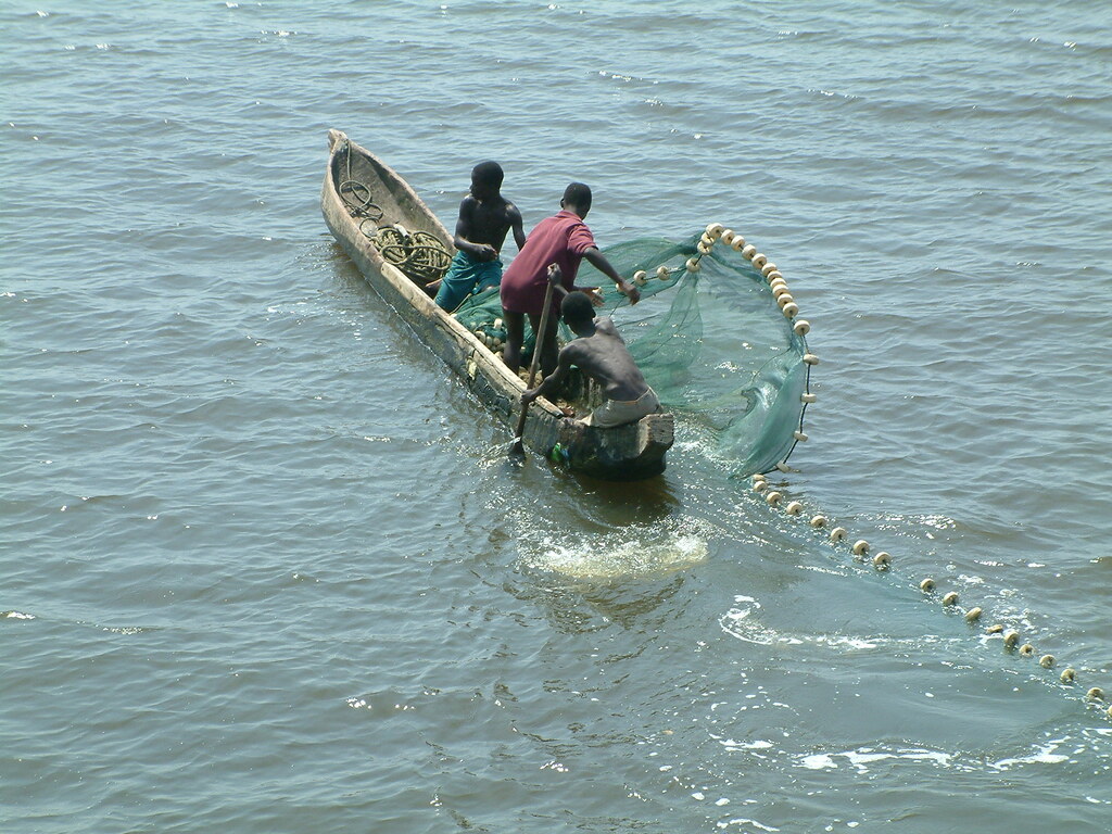
This is the once clean and beautiful Ankobra river, 1st December 2006! Fishermen had a job. One could catch fish and eat the fish! (c) Remo Kurka
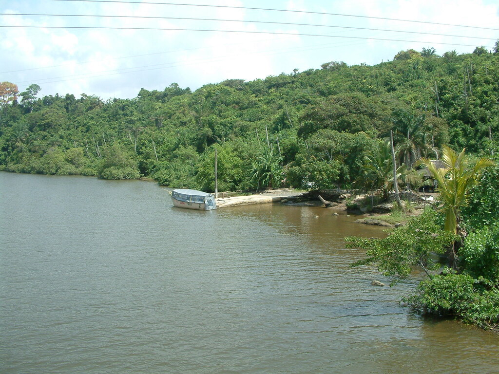
This is the once clean and beautiful Ankobra river, 1st December 2006! A community boat at the river bank (c) Remo Kurka
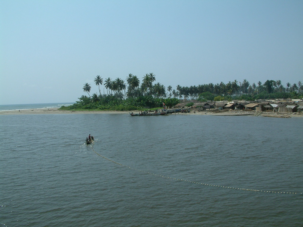
Fishermen laying the net! This is the once clean and beautiful Ankobra river, and village, 1st December 2006! A community at peace with the river. Proud of their daily work. Able to feed their families and provide enough for fish markets (c) Remo Kurka